Tornado, severe storm watches issued for parts of Kansas

Tornado and severe thunderstorm watches until 10 p.m. Central have been issued for counties from southwest to north-central Kansas.
The counties included in the thunderstorm watch are Edwards, Ellis, Finney, Ford, Gove, Graham, Grant, Gray, Haskell, Hodgeman, Kearny, Lane, Logan, Mead, Ness, Pawnee, Rush, Scott, Seward, Sheridan, Stevens, Trego and Wichita.
The tornado watch includes Barber, Clark, Comanche, Ford, Gray, Kiowa, Pratt and Stafford counties.
The better chance for strong and severe storms will come in the afternoon as the line of storms in western Kansas slides east. As the storms migrate east they will encounter an environment more favorable for strong and severe storms. These storms could produce large hail possibly topping 1.5 inches, wind gusts over 65 mph and even a few tornadoes.
Individual cells that remain isolated will pose the largest tornado threat in south-central Kansas. While a few isolated cells will be possible it appears that these storms will quickly start interacting with each other and eventually form into line segments and they slide east. As the storms merge the primary threat will become high wind gusts that could exceed 65 mph.
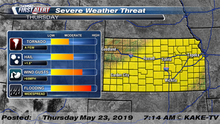
As far as timing goes for Wichita, the threat for severe weather will increase after 3pm today and the storms will likely approach from the West or Southwest. A line of storms will likely move through Wichita during the afternoon and evening before another line slides through late Thursday night into early Friday morning. The threat with the second line of storms will likely be high wind gusts that could top 60 mph.
We’ll keep you up to date with our Interactive Radar and LIVE weather coverage. Get those features and more on the free First Alert Weather App.
Click here for road conditions across the state and here to follow KAKE First Alert Storm Trackers in the field.
The threat of severe weather continues through the holiday weekend.
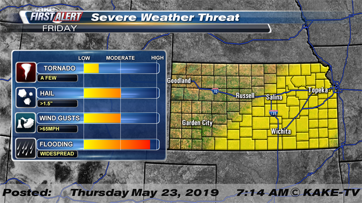
Friday will bring another chance of strong and severe storms to KAKEland and like Thursday the day might start off with some early morning shower and thunderstorm activity in South Central Kansas. During the afternoon storms are expected to intensify and expand across North and South Central Kansas and these storms could once again produce large hail stones and high wind gusts. At this time it appears that the tornado threat is a bit lower on Friday.
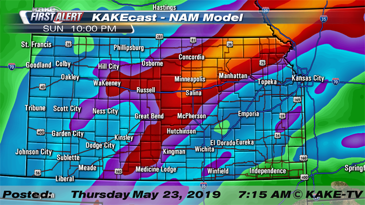
More showers and storms are expected across KAKEland over the long holiday weekend. At this time it appears that the majority of Saturday, during the daylight hours, will be dry across KAKEland but storms will return late. Storms are expected to fire up across Western Kansas late on Saturday before moving east during the evening and overnight. These storms could produce large hail, high wind and even a stray tornado. Late day storms will be possible again on Sunday and a few storms could be strong across the eastern half of the state of Kansas.
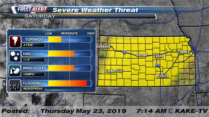
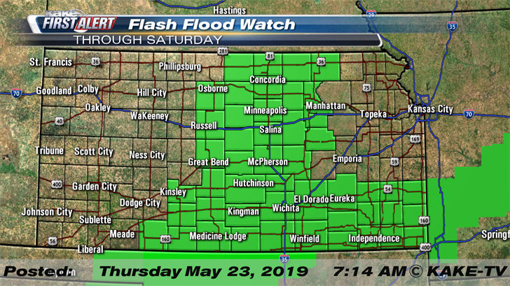
With numerous rounds of thunderstorms in the forecast, flooding remains a concern across KAKEland. A flood watch for much of North and South Central Kansas is in effect through Saturday morning.
Through the day on Saturday, Southwest Kansas along with North and South Central Kansas could see rainfall totals between 1-5” with locally higher totals possible. Northwest Kansas will likely see lower totals during this time period with most spots seeing less than 1”.